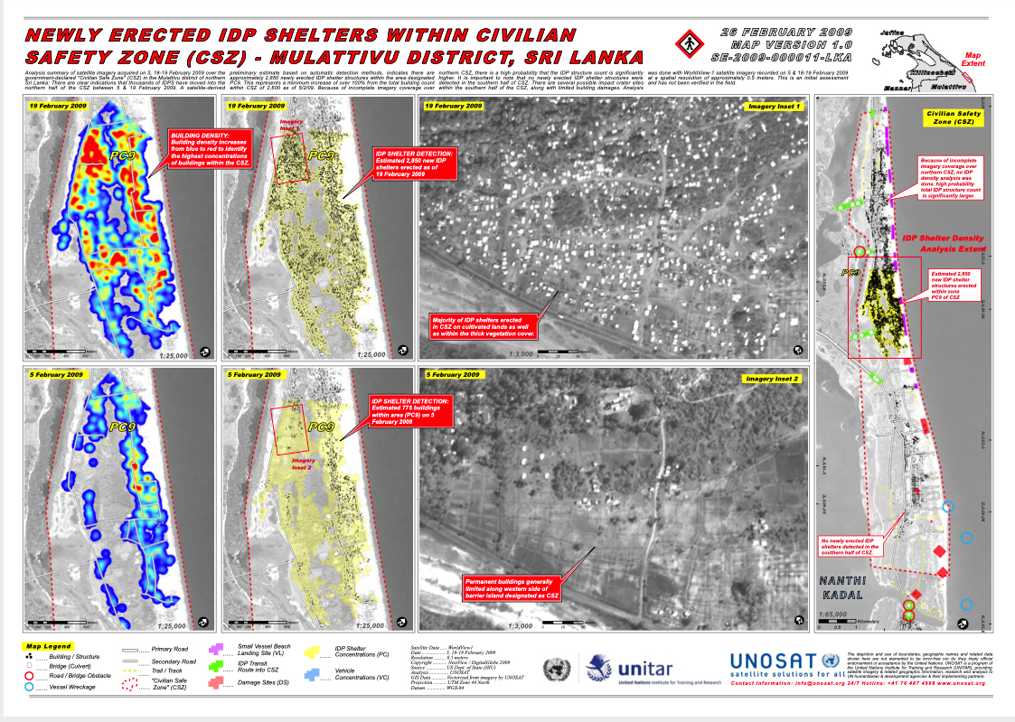

government-declared “Civilian Safe Zone”

government-declared “Civilian Safe Zone” (CSZ) in the Mulattivu district of northern approximately 2,850 newly erected IDP shelter structures within the area designated higher. It is important to note that no newly erected IDP shelter structures were at a spatial resolution of approximately 0.5 meters. This is an initial assessment
Map Extent
Civilian Safety Zone (CSZ)
Because of incomplete imagery coverage over northern CSZ, no IDP density analysis was done. high probability total IDP structure count
Sri Lanka: There are clear indications that thousands of IDPS have moved into the PC9. This represents a minimum increase of over 100% from the total building count detected in the southern half of CSZ. There are several possible impact crater sites northern half of the CSZ between 5 & 19 February 2009. A satellite-derived within CSZ of 2,600 as of 5/2/09. Because of incomplete imagery coverage over within the southern half of the CSZ, along with limited building damages. Analysis
and has not been verified in the field.
9°18’0″N 80°48’0″E
9°20’0″N 80°46’0″E
9°22’0″N 80°44’0″E
80°46’0″E 9°18’0″N
9°20’0″N
19 February 2009
19 February 2009
19 February 2009
IDP SHELTER DETECTION: Estimated 2,850 new IDP shelters erected as of
19 February 2009
Click below for full details
UNOSAT_LKA_IDP_Density_Map_CSZ_19February2009_Highres_v1